01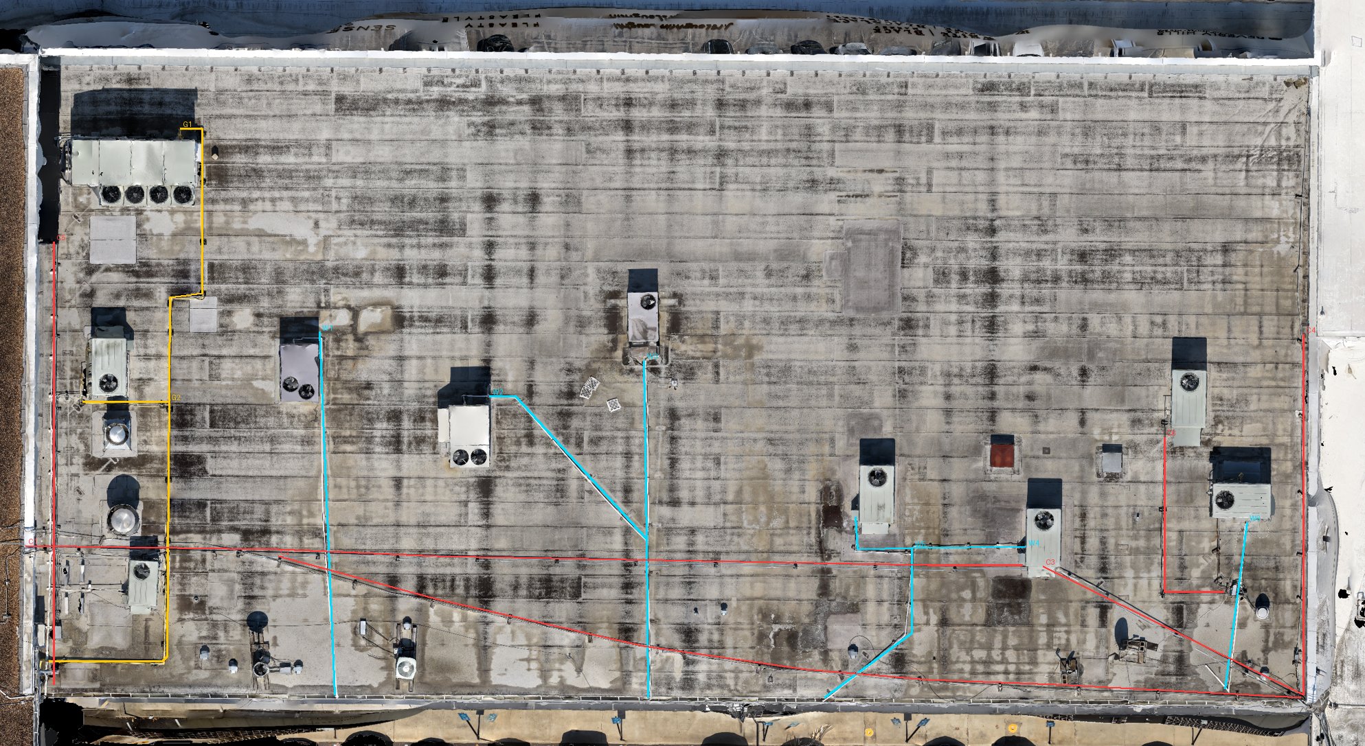
Critical Asset Inspection
See every defect without sending a crew up a ladder. Safer, faster, and fully documented.
- Roofs, structures & facades
- High-res + thermal-ready capture
- Findings ranked by severity
Drone-powered asset inspection, site progress and documentation, 360 SiteView tours, and 2D & 3D models — delivered by certified pilots across Houston and Texas.
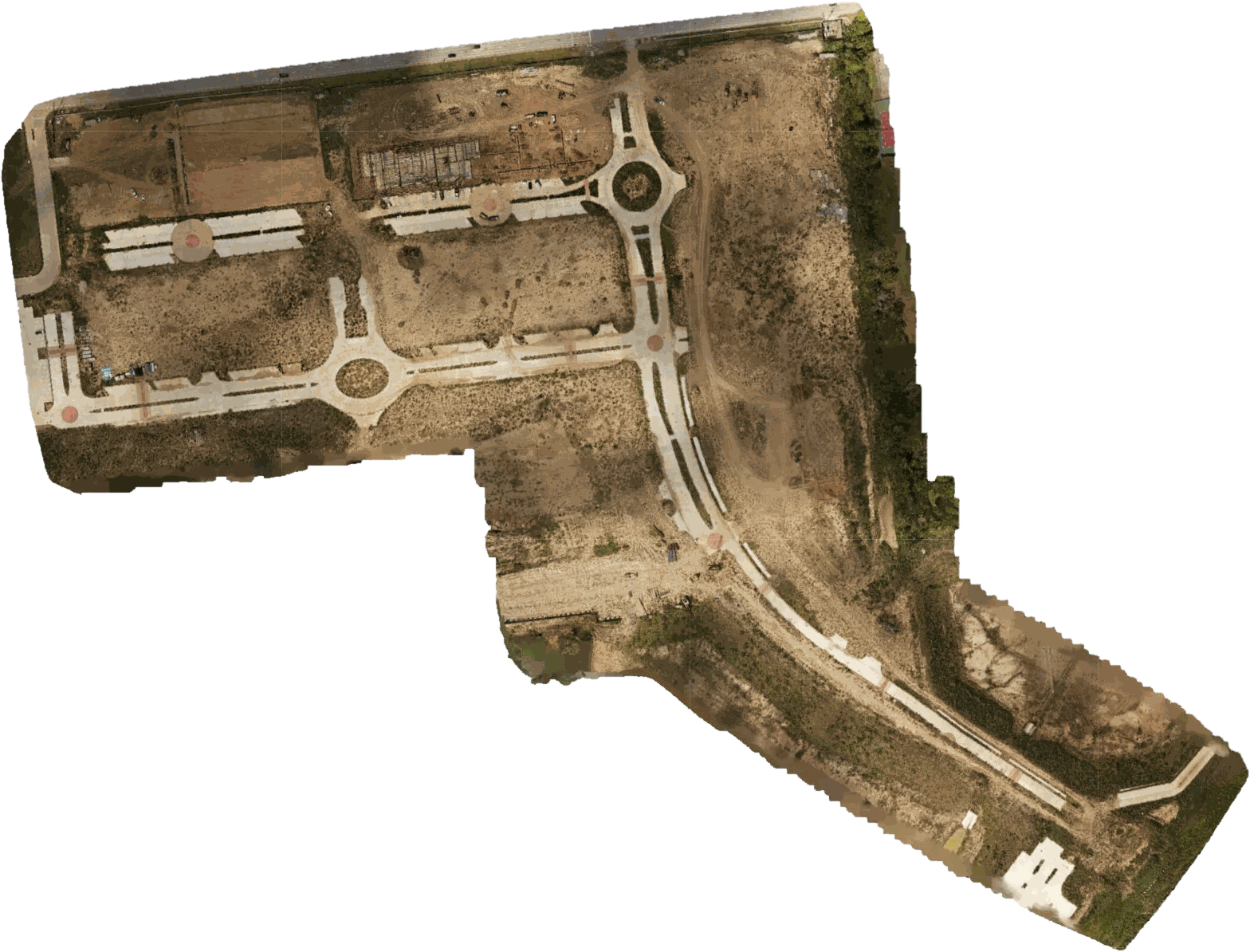 AUTONOMOUS FLIGHT PLAN
ORTHOMOSAIC · 2D
DSM · 3D
Whether you need to inspect an asset, prove progress, document a site, or measure it in 3D — we capture the data, process it, and deliver decision-ready results.
See every defect without sending a crew up a ladder. Safer, faster, and fully documented.
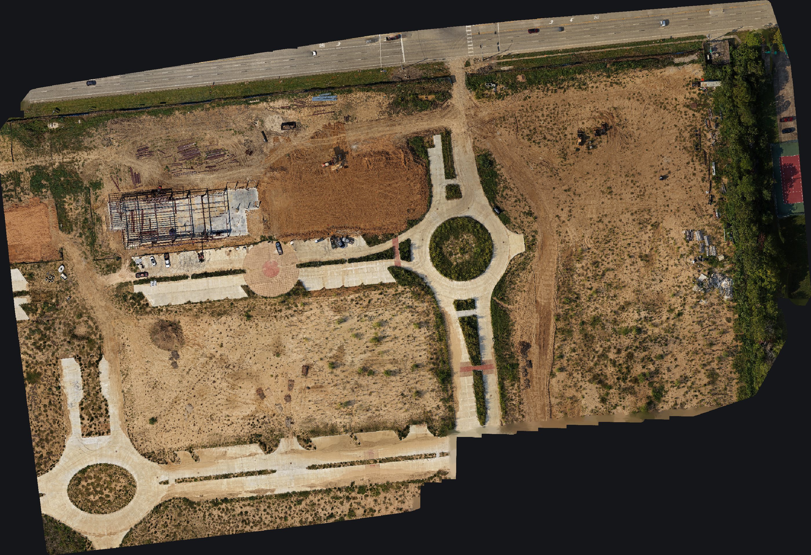
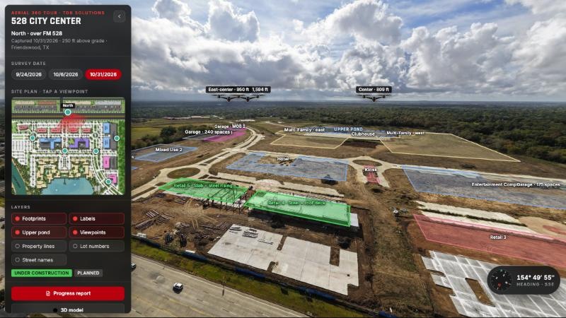
Recurring flights and 4K photo & video turn your job site into a dated, shareable record — built vs. planned.
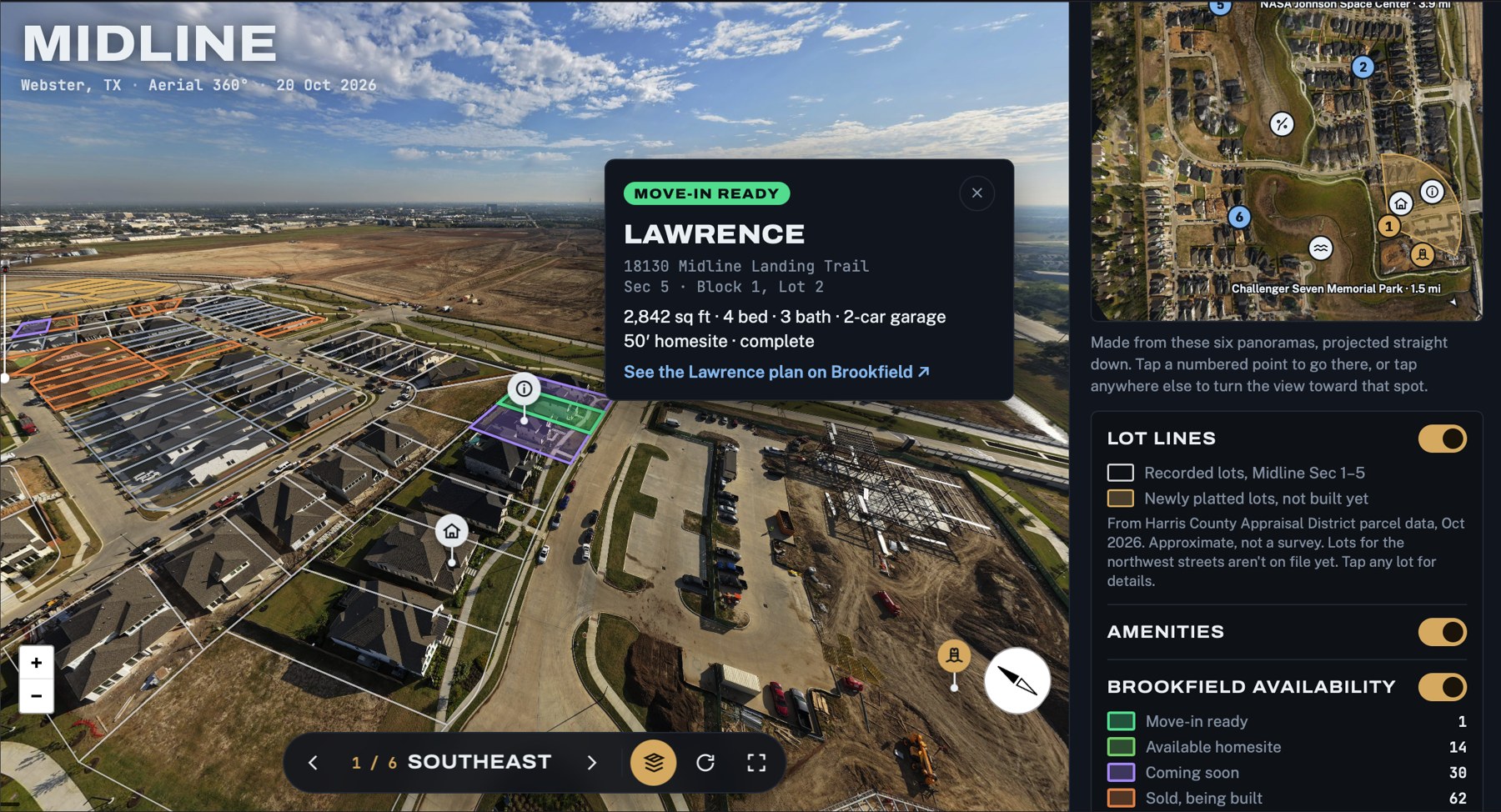
Interactive aerial 360° tours that let visitors explore a property and see where everything is.
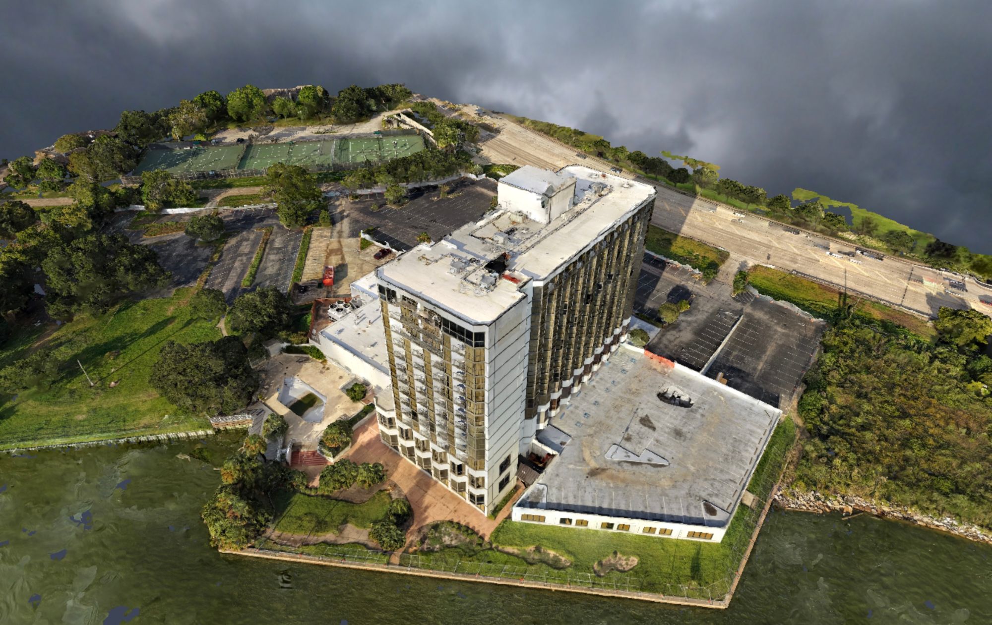
Measurable orthomosaics, elevation maps and photorealistic 3D models — a digital twin of your site.
Every flight becomes a dated, bird's-eye record of what's really built — so owners, lenders and GCs can verify progress without a site visit.
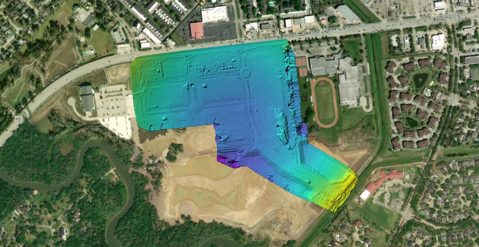
Thousands of drone images are stitched into survey-style maps and photorealistic 3D models you can measure, rotate and share from any browser.
From active job sites to occupied properties, we bring aerial intelligence to the industries that can't afford surprises.
Progress tracking, earthwork volumes and dated documentation for builders, GCs and owners.
Learn moreSafer inspection of towers, lines, pipelines and rights-of-way without sending crews aloft.
Learn moreRoof, facade and site condition assessments for owners, managers and lenders.
Learn moreDamage and dimension reports from 3D models — accurate, fast and fully documented.
Learn moreAerial photography, 360° views and 3D property models for listings and land sales.
Learn moreFully licensed and compliant, with $1M liability insurance on every mission.
Land, pipeline, utility and ROW survey experience — we understand the ground, not just the sky.
4K and thermal-capable aircraft with precision GPS — the right tool for every mission.
Polished deliverables in as little as 24–48 hours. No agency waiting games.
“TDB Solutions has been a huge asset to Williams Pool Company. From the incredible drone footage, video editing and marketing content. TDB Solutions has elevated the way we can showcase our projects online. With cinematic aerial footage and clean professional social media content, TDB Solutions has helped us stand out across multiple platforms to attract more attention to our or brand. Thank You- Danny Williams”
“TDB Solutions exceeded our expectations with their 360 viewer and attention to detail. They provided a comprehensive commercial roof inspection, complete with high-quality aerial imagery and a detailed written report. Their thorough documentation and clear findings made it easy to assess the roof’s condition. Highly recommend their services.”
“Built me a very professional website for half the price of what I was charged by the last company who did not do half as good a job. Also had them film some drone footage 10/10. They were very helpful and professional throughout the process. TDB helped get my business on track and I can’t thank you enough!”
“TDB Solutions Provided me an amazing aerial data for our job site 10/10 will definitely use again! Appreciate the service!”
“Highly recommend! TDB Solutions provided excellent 2D & 3D maps for our construction site, will use for future projects. Great work”
“TDB Solutions provided excellent aerial videography and photography for our real estate listing. Highly recommend!”
It's the process of turning drone-captured imagery into answers: where a roof is failing, how much of a site is built, how much dirt has moved, or what a property looks like from every angle. We handle the flying, the processing and the reporting.
Roofs, building exteriors and facades, structures, towers and other elevated or hard-to-reach assets. Tell us what you manage and we'll scope the right sensors, flight plan and deliverables.
As often as your project needs — weekly, bi-weekly, monthly, or at key milestones. We repeat consistent flight paths so each dated record compares cleanly with the last.
Depending on the scope: 2D orthomosaic maps, DSM elevation maps, interactive 3D models, annotated inspection or progress reports in PDF, TDB 360 SiteView° tours, and edited 4K photo and video. Typical turnaround is 24–48 hours.
No. That's the point — your team can review everything remotely. We coordinate access and safety on the day of the flight.
Yes. Every pilot is FAA Part 107 certified, and TDB carries $1M in liability insurance. We're also a BBB Accredited business. A certificate of insurance is available on request.
Accuracy depends on the mission and whether ground control points are used. For measurement-critical work we plan the flight and control to match your tolerance — just tell us the requirement up front.
We're based in Friendswood and serve the Greater Houston area and projects across Texas. Reach out for work farther afield.
Tell us about your project and we'll send back a flight plan and quote — fast.
4310 Saffron Ln · Friendswood, TX · Serving Greater Houston & Texas