An unbiased view of your entire job site.
Weekly flyovers turn your build into a shareable, timestamped record: dated orthomosaic maps, elevation models and photogrammetry 3D models that show what's built vs. planned, so owners, lenders and contractors can verify progress without a site visit.
Watch the build come together.
Two ways we turn drone flights into a clear, measurable record of your project.
Progress Tracking
Footage from repeat drone flights over residential, commercial, and site-prep projects, with percent complete and flight date logged at every milestone.
Why it matters: owners, lenders, and stakeholders see the build unfold as a visual timeline, delays surface early, and you keep a dated record for updates, draw requests, and disputes.
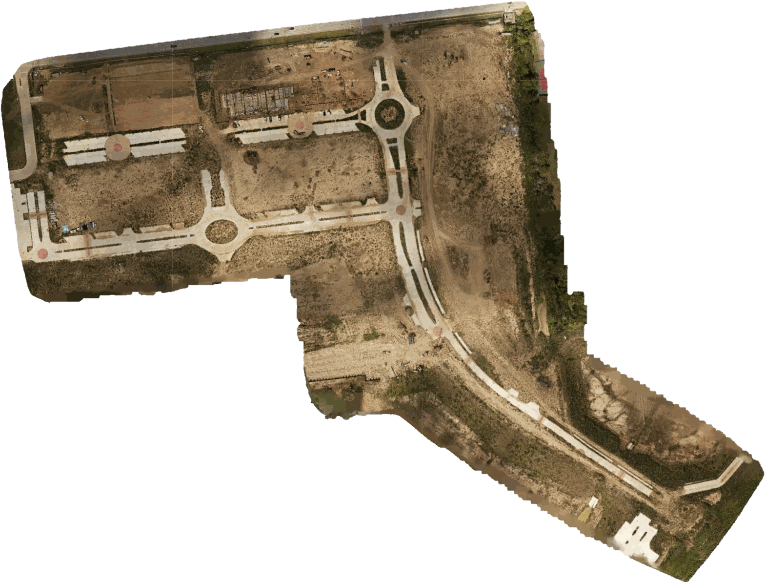
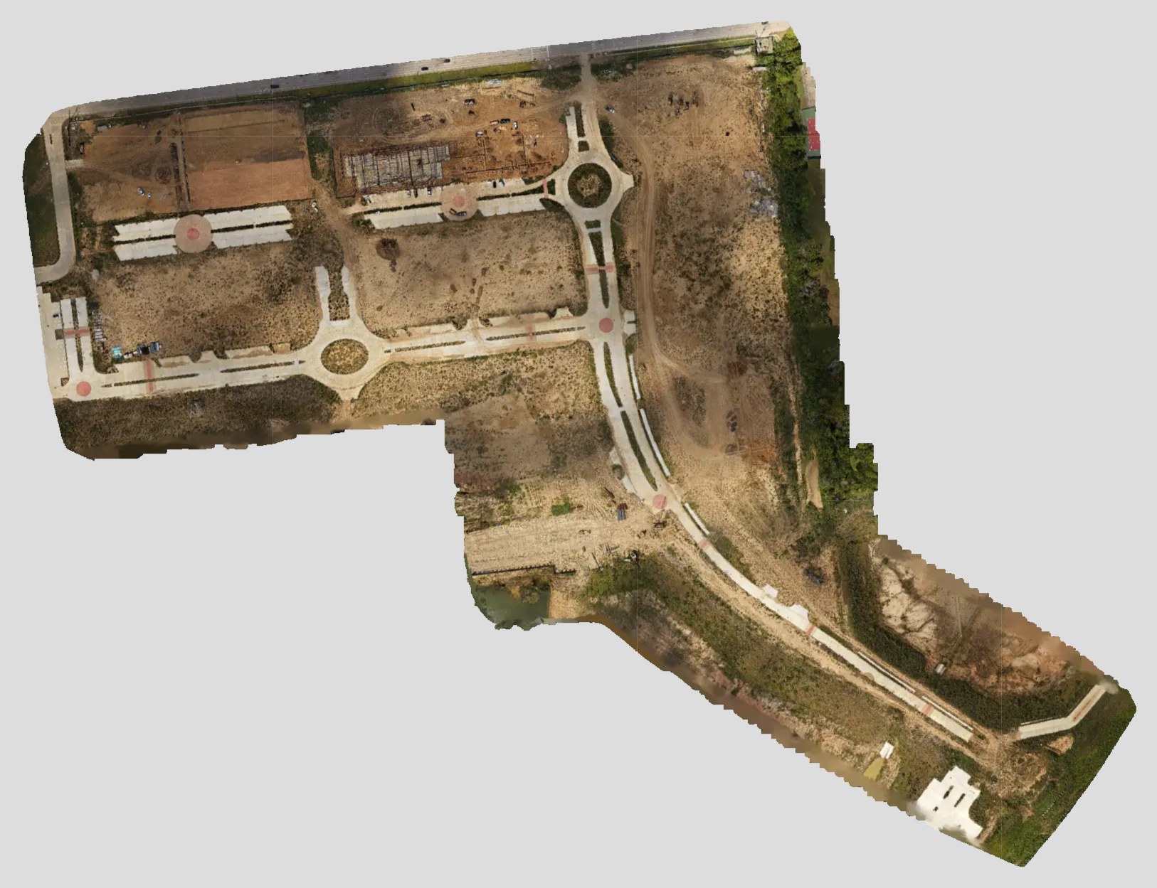
2D Orthomosaic: 528 Town Center
A top-down, distortion-corrected map stitched from hundreds of overlapping drone photos into a single high-resolution image of the entire site.
Why it matters: unlike a regular aerial photo, an orthomosaic is to scale, so distances and areas can be measured, plans can be overlaid, and each flight can be compared against the last to verify paving, grading, and earthwork progress.
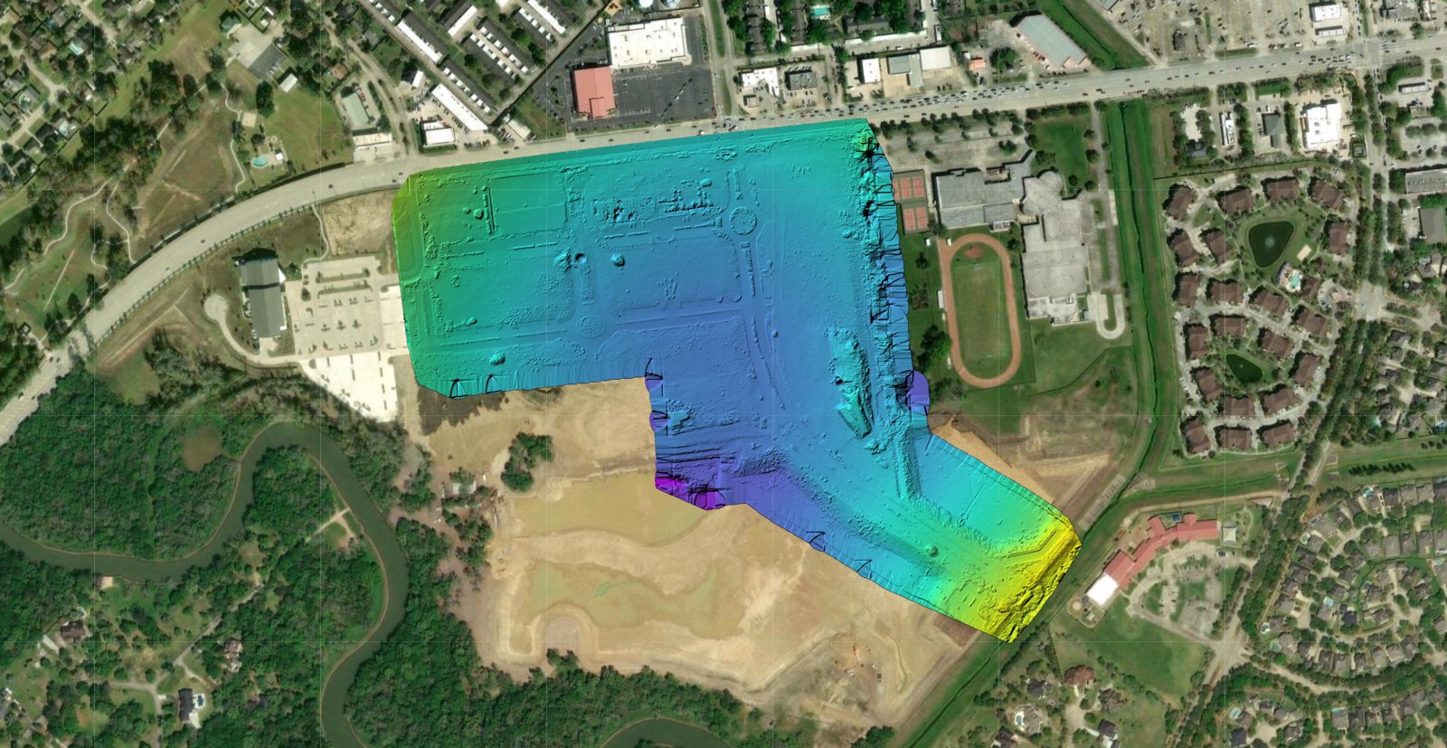
Digital Surface Model: Elevation
A DSM is an elevation map built from the same drone flight. Every point on the site is assigned a height, and the map is color-coded so high and low areas are visible at a glance, including buildings, stockpiles, and grade changes.
Why we collect it: elevation data lets you verify grading and drainage, calculate cut/fill and stockpile volumes, and measure change between flights. It turns "it looks like progress" into numbers you can bill, plan, and check against design.
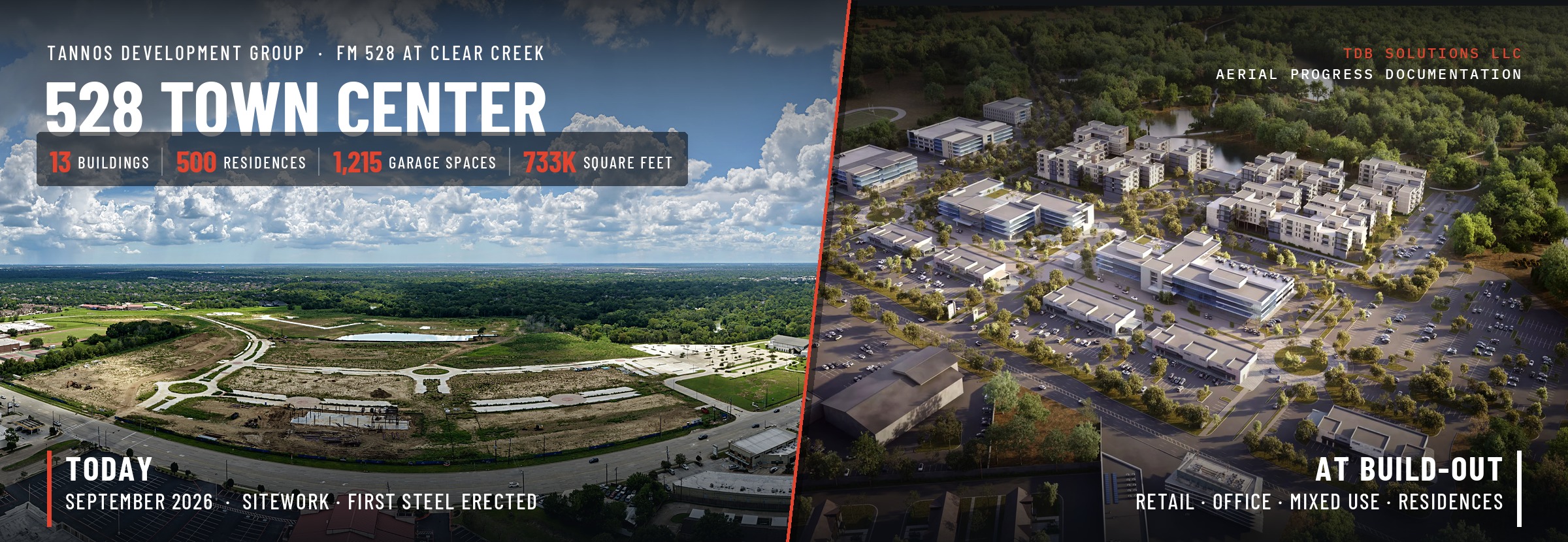
Same site. Two dates. Real progress.
Repeatable flight paths produce apples-to-apples orthomosaics, so every change between flights is visible, measurable and dated.
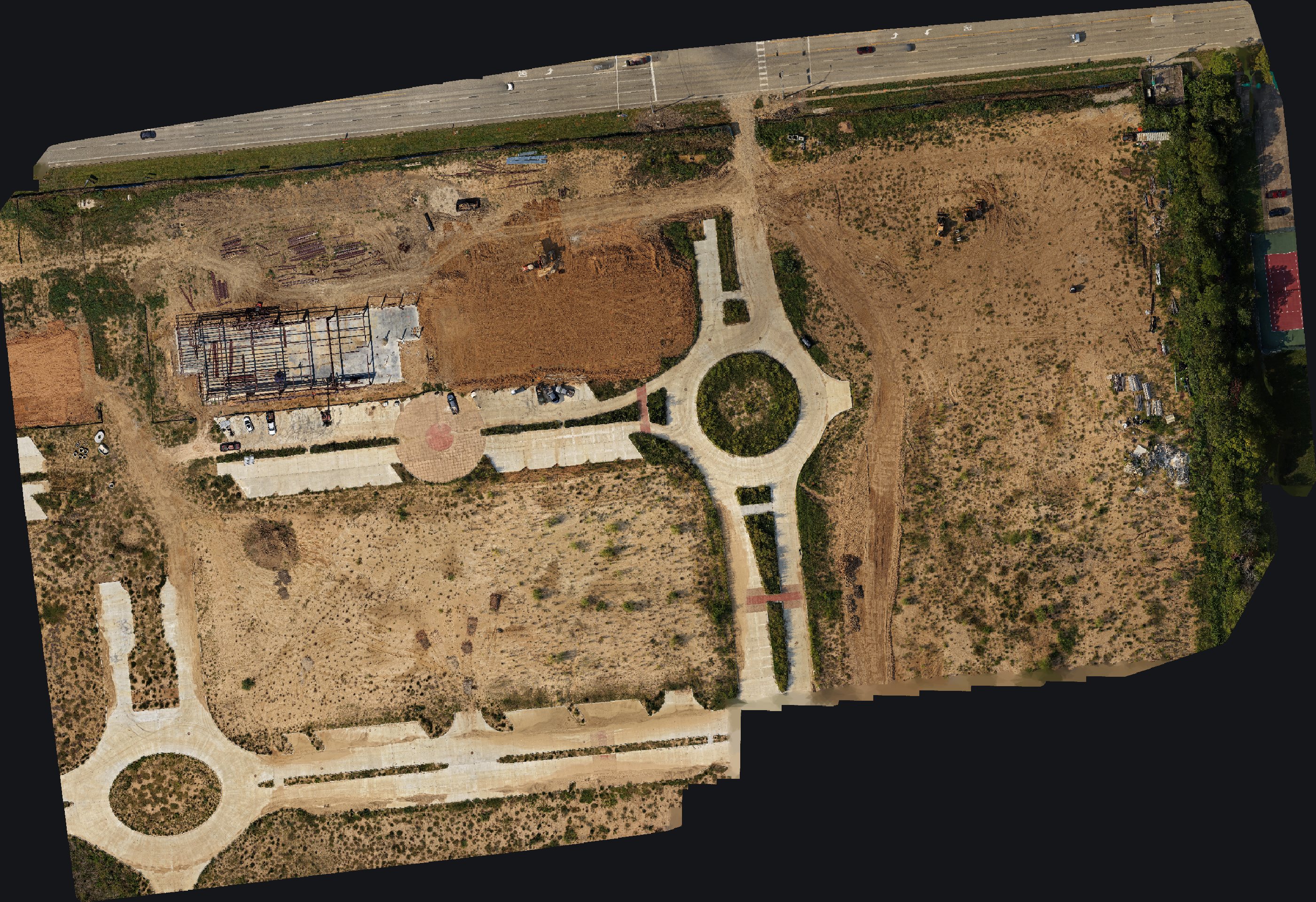
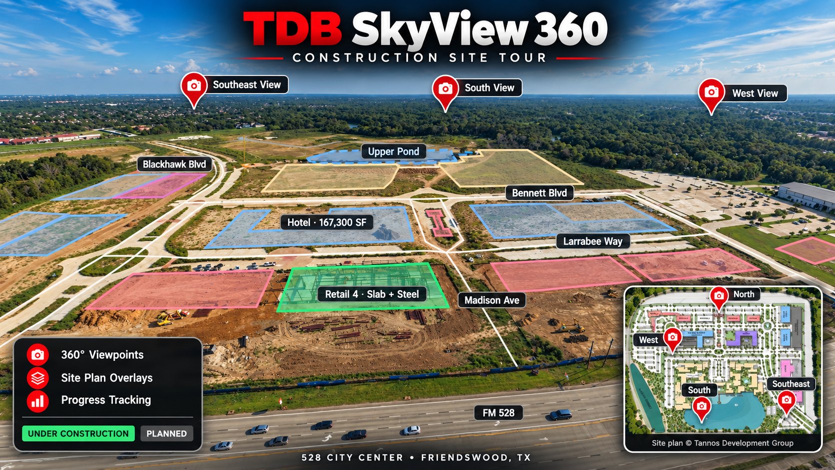
528 Town Center: 360 Tour & Progress Report
A mixed-use development at FM 528 & Clear Creek in Friendswood. Every flight becomes an interactive TDB 360 SiteView tour and a documented progress report.

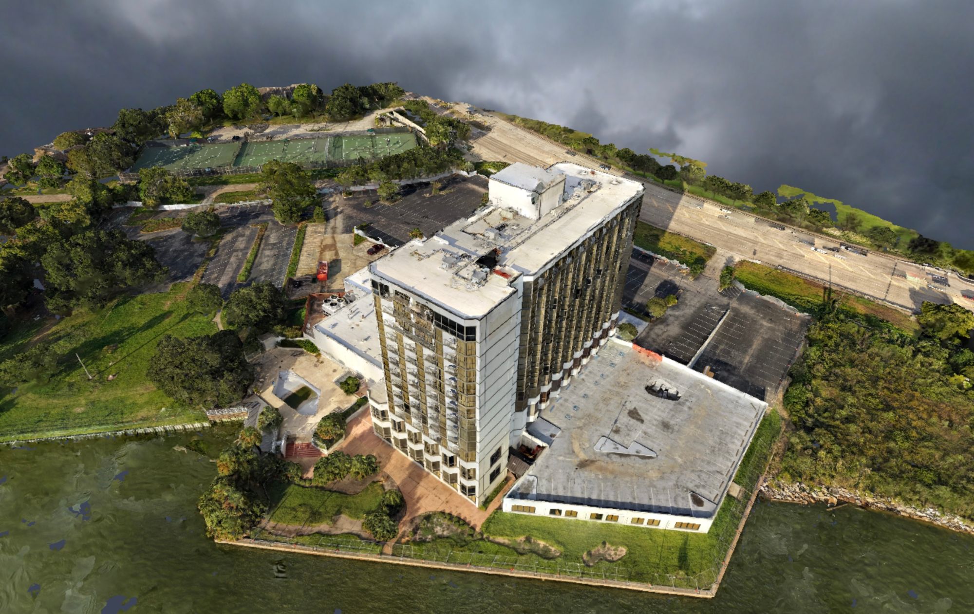
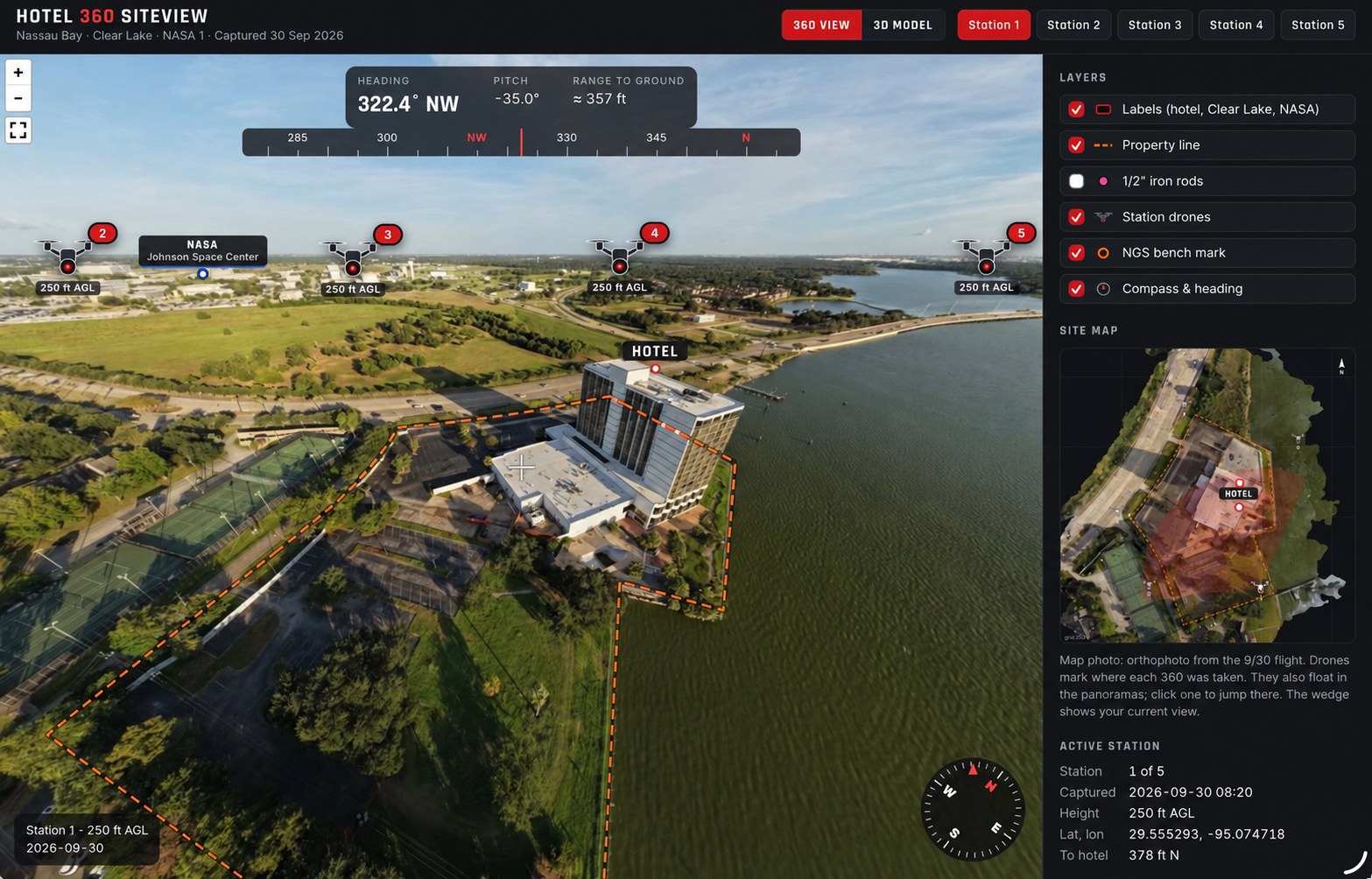
Your site as a digital twin.
Photogrammetry-based models of your site, shareable from any browser with no special software. Drag to rotate, scroll to zoom, and measure what's actually on the ground.
- 2D orthomosaics: high-resolution, georeferenced maps ready for GIS and site-planning software
- DSM elevation maps for grading, drainage and volume work
- 3D site models in industry-standard formats to integrate with BIM workflows or share instantly
- Repeat captures to compare versions over time
Everything your project needs.
Construction sites move fast and mistakes are expensive. From foundation pour to final walkthrough, we give project managers, owners and contractors the visibility to catch problems before they become costly.
Progress Tracking
Scheduled flyovers at key milestones give you a time-lapse record of your entire build, perfect for owner updates, lender reports, and disputes.
3D Site Modeling
Photogrammetry-based 3D models of your site delivered in industry-standard formats. Integrate with BIM workflows or share with stakeholders instantly.
Volume Calculations
Accurately measure stockpiles, cut/fill volumes, and earthwork quantities from the air, faster and safer than ground-based surveying.
Safety Documentation
Aerial documentation of site conditions, safety compliance, and hazard areas, giving you a defensible record if any safety incidents occur.
Timeline Documentation
Build a visual record of your project from day one. Perfect for marketing completed builds, resolving contractor disputes, or presenting to investors.
Orthomosaic Maps
High-resolution, georeferenced aerial maps built using photogrammetry, with real-world coordinates, ready for use in GIS platforms and site planning software.
Every visit, photographed and dated.
Each flight also delivers 4K aerial photos and edited video, so you have a time-stamped visual record of the project from pre-construction to as-built. Add a TDB 360 SiteView tour and owners, lenders and tenants can explore the site themselves, with the site plan drawn right on the ground.
Built for Houston's construction market.
We understand construction timelines, stakeholder expectations, and the unique challenges of building in the Houston market. Our team doesn't just fly drones; we understand what project managers actually need to see.
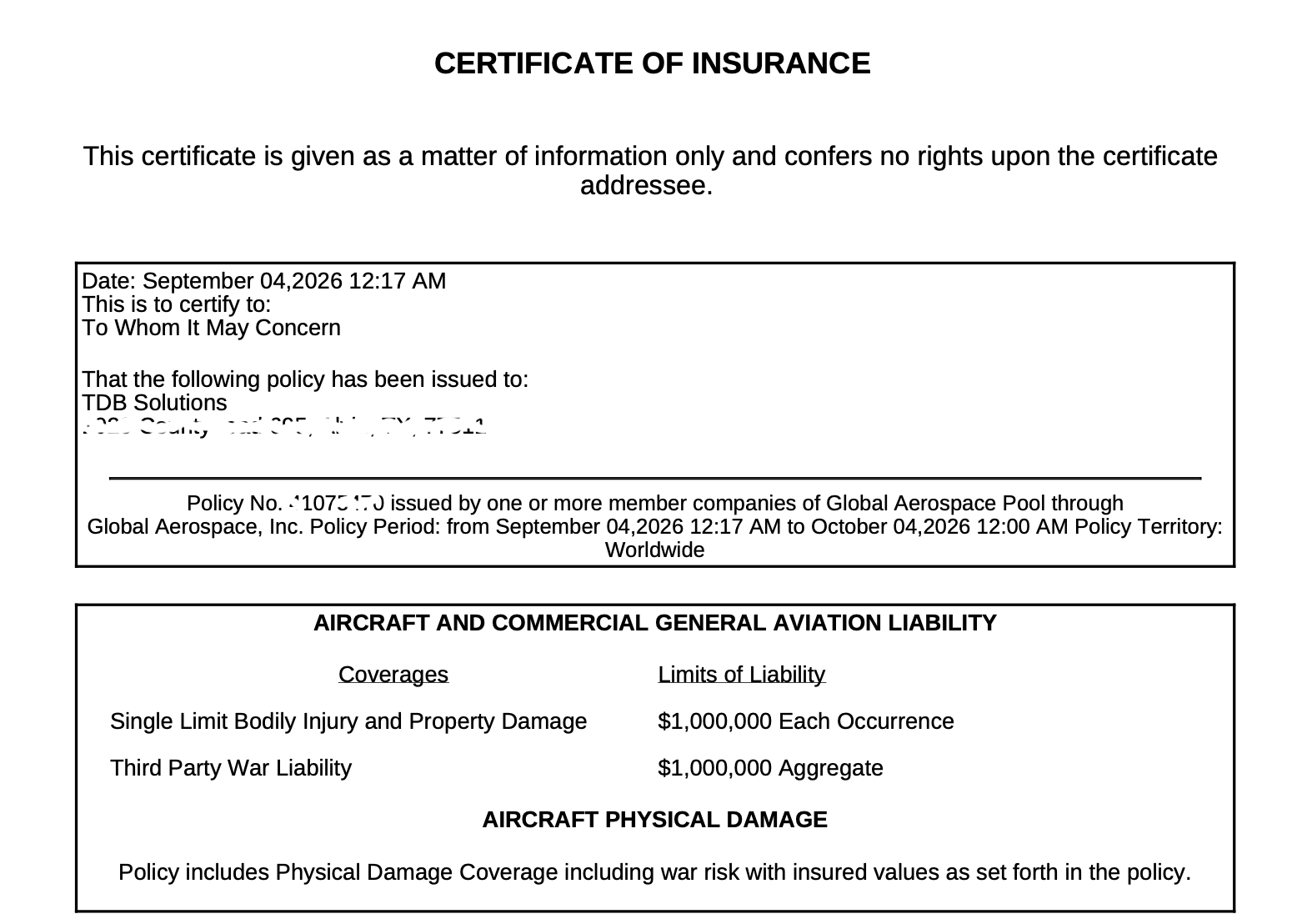
- FAA Part 107 certified pilots with full liability insurance
- We coordinate with your site safety officer and work around active crews
- Organized, labeled deliverables, not just raw footage
- One-time documentation flight or full project coverage, built around your schedule and budget
From takeoff to decision-ready in four steps.
Plan the Flights
We set a repeatable flight path and cadence (weekly, bi-weekly or monthly) around your schedule and active crews.
Capture the Site
FAA Part 107 pilots fly the site and capture photos, video and overlapping imagery for mapping.
Process & Model
Photogrammetry builds the orthomosaic, DSM and 3D model, typically delivered in 24–48 hours.
Share the Record
Dated maps, models and progress reports you can share with owners, lenders and contractors, building a timestamped history flight by flight.
Construction pricing.
From a single photogrammetry capture to full monthly coverage. Pick what fits your project.
3D Model / Photogrammetry
No ongoing commitment — just a single flight, processed into a full 3D model or orthomosaic map.
- One aerial capture flight
- Photogrammetry-processed 3D model
- Georeferenced orthomosaic map
- Shareable interactive model link
Bi-Weekly Site Visits
Ideal for projects that just need regular check-ins.
- Site visit every 2 weeks
- Aerial site photos
- Aerial site video
- Progress update form for the trip
Optional Add-Ons
- 3D model of the latest completed section of the project — $200
- Cinematic marketing reel recapping the project — ask for pricing
- On-camera interview with a project representative — ask for pricing
Monthly Full Coverage
For projects that need consistent, ongoing coverage.
- 1 site visit per week
- Updated site photos
- Updated site video
- Monthly progress report
Optional Add-Ons
- 3D model of the latest completed section of the project — $200
- Cinematic marketing reel recapping the project — ask for pricing
- On-camera interview with a project representative — ask for pricing
Site progress tracking, answered.
How often can you fly my site?
Most projects run weekly, bi-weekly or monthly flyovers. Repeatable flight paths keep each capture directly comparable to the last. A one-time documentation flight is also available.
What do I receive after each flight?
Depending on your package: aerial photos and video, a dated orthomosaic map, a DSM elevation model, a 3D model, and a progress report. Deliverables are organized and labeled, and typically turned around in 24–48 hours.
Can I share the results with my lender, owner or GC?
Yes. Maps, models and reports are shareable, and every flight is timestamped, giving you a dated record for owner updates, draw requests and disputes.
Can you measure stockpiles and earthwork?
Yes. Elevation data from each flight supports stockpile, cut/fill and earthwork volume measurement, and lets you measure change between flights.
Are you licensed and insured?
Every flight is performed by an FAA Part 107 certified pilot, and TDB Solutions carries $1M in liability insurance. We're BBB Accredited and coordinate with your site safety officer around active crews.
Where do you work?
We're based in Friendswood, TX and serve the Greater Houston area and Texas.
Let's document your next build.
Tell us about your project and we'll put together a coverage plan that fits your schedule and budget.
4310 Saffron Ln · Friendswood, TX · Serving Greater Houston & Texas